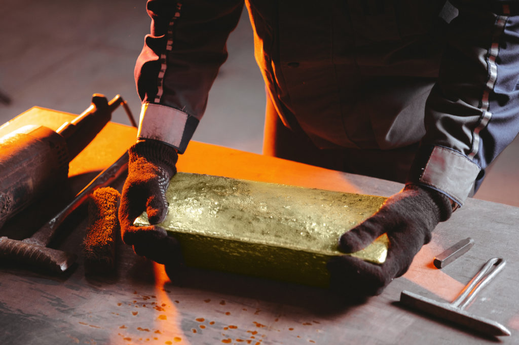
Mining
Will Africa's Resource Powers Shaping Global Markets, Politics, and Climate?


Africa is the second-largest continent in the world, covering more than 30 million square kilometers. Within this vast landmass lie deserts, mountains, savannas, forests, and coastlines that shape how people live and how economies grow. Land area plays a central role in defining national potential, yet it is often misunderstood.
The continent contains some of the world’s most striking geographic features. The Sahara Desert, the largest hot desert on Earth, stretches across 11 nations and influences trade, settlement, and agriculture. The Congo Basin holds the second-largest rainforest in the world, serving as a vital source of biodiversity and fresh water. Beneath the soil and along the coasts are some of the planet’s richest reserves of oil, gas, and minerals, making Africa strategically important to global energy and resource markets.
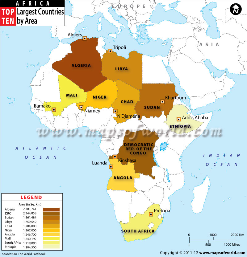
In this article, we rank the 10 largest African countries by land area in 2025 and explore how geography influences their economies, living conditions, and position on the continent.
10. Ethiopia
Ethiopia’s land size plays a direct role in shaping its economy. Covering more than 1.1 million square kilometers, it offers a wide range of climates and fertile zones that support agriculture at scale. The highlands support food production, growing teff, barley, and wheat for both local consumption and export. Ethiopia’s coffee, grown on these elevated slopes, is one of Africa’s most recognized products, driving trade links well beyond the continent. Rivers such as the Blue Nile turn the country’s size into an energy resource, with projects like the Grand Renaissance Dam positioning Ethiopia as a regional power supplier.
For the people, geography defines daily life. Most of Ethiopia’s 120 million citizens live in the highland plateaus where the climate is milder and the soil is productive. The lowland areas are more sparsely populated, often used for livestock and seasonal farming. This clustering shows how land size isn’t evenly lived on but concentrated in zones where life is more sustainable. Still, the spread of land has allowed Ethiopia to host a diversity of cultures and languages, each tied to its region and history.
In Africa, Ethiopia’s size gives it weight. Despite being landlocked, it serves as a central state in the Horn of Africa, connecting trade routes that pass through Djibouti, Somaliland, and Kenya. Its rivers affect downstream countries, making it a key player in Nile politics, while its population and landmass combined make it one of Africa’s natural leaders.
9. South Africa
South Africa’s land size gives it one of the most diverse economies on the continent. Within its 1.2 million square kilometers lie mineral-rich regions that have made it a global supplier of gold, platinum, and diamonds. This natural wealth built South Africa’s mining sector, which still anchors its economy today. Beyond minerals, the land supports large-scale agriculture, wine, maize, and citrus fruits, making the country one of Africa’s leading food exporters. Its long coastline along both the Atlantic and Indian Oceans also boosts trade, giving South Africa direct access to international shipping routes.
For the population, geography shapes where and how people live. The coastal cities of Cape Town, Durban, and Port Elizabeth thrive on trade and tourism, while the interior plateau supports both farming communities and industrial hubs like Johannesburg and Pretoria. South Africa’s varied climate, from Mediterranean conditions in the Cape to semi-arid zones in the Karoo, creates different ways of life, but together they highlight how much the land accommodates.
Regionally, South Africa’s size makes it a strategic link between southern Africa and the rest of the world. It is often seen as a gateway for trade into the continent, with its ports handling cargo not only for its own needs but also for neighboring landlocked countries.
8. Mali
Mali is Africa’s eighth-largest country, stretching across more than 1.2 million square kilometers. Despite its size, much of the land lies in the Sahara Desert, making only the southern third suitable for farming and settlement. This explains why the majority of Mali’s population of over 22 million people live in the fertile areas along the Niger River.
The country’s geography has always shaped its role in Africa. Historically, cities like Timbuktu and Gao were central to trade across the Sahara, linking West Africa with North Africa and beyond. Today, Mali’s position still makes it a bridge between regions, though maintaining security across such a vast, sparsely populated territory remains a constant challenge.
Mali’s economy relies heavily on what its land provides. Agriculture employs about 70% of the workforce, with cotton and livestock among the main exports. Mali tops the list of Africa's highest cotton producers in 2025. Mali is also one of Africa’s top gold producers, and mining has become the country’s largest source of export revenue. The size of the country means untapped mineral potential is likely, though infrastructure gaps limit access to remote areas.
7. Angola
Angola’s land size makes it one of the giants of Southern Africa, and its resources show just how important size can be to an economy. Beneath its soil lie oil, diamonds, and minerals that drive much of its national income. The oil fields, especially off the coast, make Angola one of Africa’s top oil producers, while fertile zones in the interior give space for farming that supports both local consumption and exports.
For the people, Angola’s geography offers variety. The Atlantic coastline hosts busy ports like Luanda, which connect the country to global trade. Inland, the land shifts to plateaus and rivers, allowing for agriculture, livestock, and hydropower. Still, much of Angola’s population lives along the coast and central plateau, while other areas remain underdeveloped despite their potential. This uneven use of land reflects how settlement and infrastructure are concentrated in specific regions.
Regionally, Angola’s size and resources give it influence. It shares borders with seven countries, linking Southern Africa with Central Africa. Its oil exports make it a significant player in global energy, while its diamonds and fertile land add to its strategic value. For Africa, Angola’s position as both a resource hub and a connector gives it weight in politics and trade.
6. Niger
Niger’s land size of 1,268,642 km² (489,825 mi²) has a direct impact on both its economy and its people. About four-fifths of the land lies within the Sahara, making it dry and difficult for farming. Still within this territory lie valuable resources: Niger is one of the world’s top producers of uranium, which powers energy plants globally. The country’s land also supports cattle rearing and small-scale farming in the southern belt, where rainfall is more reliable.
For Nigeriens, geography dictates where life is possible. The majority of the population is concentrated in the south near Nigeria and along the Niger River, where farming and trade are most active. The north, though expansive, is sparsely populated, home to nomadic Tuareg and Fulani groups who move with their livestock. Niger’s location makes it a central player in the Sahel. It borders seven countries, linking North Africa to West and Central Africa. Its size and position give it importance in regional security and trade routes, even though it is landlocked. The uranium deposits also make Niger strategically important on the global stage, as countries depend on its supply for nuclear energy.
5. Chad
Chad sits at the heart of Africa, and its size gives it both opportunities and challenges. With a total area of around 1,300,000 km2 (500,000 sq mi), Chad is the fifth-largest country in Africa. The country’s vast land covers desert in the north, savannah in the center, and more fertile zones in the south. This variety means the land supports different forms of life: the northern Sahara is sparsely populated but rich in minerals, while the central and southern regions sustain farming and cattle rearing. Oil also plays a major role in Chad’s economy, with reserves found beneath its wide territory.
For the population, geography deeply shapes daily living. Most people live in the southern belt, where water and farmland are more available, while the arid north is home to nomadic groups who move across the desert. Lake Chad, though reduced in size over the years, remains a vital lifeline, supporting fishing, irrigation, and cross-border trade for millions. This uneven use of land shows how size alone doesn’t always translate into equal benefit; it depends on how the land can be lived on.
Chad’s position adds to its importance. It borders six countries, that is, is bordered by Libya to the north, Sudan to the east, the Central African Republic to the south, Cameroon to the southwest, Nigeria to the southwest (at Lake Chad), and Niger to the west. This makes it a bridge between North, Central, and West Africa. This strategic location gives it influence in regional trade and politics, even though its landlocked nature limits direct access to global markets. Still, its size and resources keep it on the map as a player in both African energy and agriculture.
4. Libya
Libya’s land size places it among Africa’s giants, but what makes it especially important is not just how big it is, but what lies beneath its soil. More than 90% of Libya’s 1.8 million km² (700,000 sq mi) is a desert and nevertheless, this land holds some of the largest oil reserves in Africa. Oil is the backbone of its economy, and the country’s vast territory allows for large-scale extraction and export, making Libya a key energy supplier to Europe and beyond.
For everyday life, geography has a sharp impact. Most Libyans live along the Mediterranean coast, where the land is more fertile and the climate is milder. Cities like Tripoli and Benghazi thrive here, while the interior desert is sparsely populated, with small communities and nomadic groups. This uneven settlement pattern shows how people adapt to land that is abundant in size but harsh in conditions.
Libya’s location gives it regional weight. Its coastline provides access to the Mediterranean, linking Africa directly to southern Europe. At the same time, its land borders six African nations, among them Chad, Niger, and Sudan. This makes it a connector between North Africa and the Sahel. The combination of size, oil, and location means Libya plays a role not just in Africa’s economy but also in global energy security.
3. Sudan
With its 1,886,068 square kilometres (728,215 square miles), Sudan is Africa’s third-largest country. Stretching across the Sahel into the Sahara, the land offers both opportunity and difficulty. Its soil, especially along the Nile, is rich and supports large-scale farming. Crops like sorghum, wheat, and cotton have long been part of Sudan’s agricultural backbone, feeding its people and supplying exports. At the same time, the country’s land hides minerals and oil, resources that shape its economy and international relationships.
For Sudanese people, geography defines daily life. The Nile River is the heart of settlement and survival, drawing millions to its banks for fmeanswateis r supply. Sudan’s size gives it regional importance. It borders seven countries and acts as a gateway between North Africa, the Horn of Africa, and Sub-Saharan Africa. Its location near the Red Sea also gives it access to international trade routes. For Africa, Sudan’s land means not only resources but also connectivity, its position means it is a crossroads of cultures, economies, and politics.
2. Democratic Republic of Congo (DRC)
The Democratic Republic of Congo is not only Africa’s second-largest country but also one of its richest in natural endowment. Beneath its vast land lie cobalt, copper, gold, and coltan minerals that power the world’s phones, laptops, and electric cars. Its forests, rivers, and fertile soil also make it central to global conversations on climate and sustainability. The Congo Basin rainforest, second only to the Amazon, acts as a massive carbon sink for the planet.
For Congolese people, the land gives both promise and hardship. The Congo River provides transport, fish, and hydropower, linking communities across the heart of the country. The fertile land means agriculture could easily feed not just the DRC but neighboring countries. Yet, because infrastructure is limited, much of this potential remains untapped, and many communities live far from reliable roads, schools, or hospitals. A vast size without enough connectivity means some areas feel cut off from the rest of the country.
Regionally and globally, DRC’s size makes it influential. It shares borders with nine countries, giving it a central role in African trade and politics. Its minerals are critical to the world’s clean energy transition, making it a strategic player in the global economy. At the same time, its forests and rivers are vital to Africa’s environment, giving it a voice in climate talks that few can ignore.
1. Algeria
With its 2,381,741 km2 ( 919,595 sq miles) land mass, Algeria holds the title of Africa’s largest country. Her size is more than just a statistic it directly shapes its economy, society, and global standing.
Much of its land is taken up by the Sahara Desert, but beneath those sands lie oil and natural gas reserves that fuel its economy and make it one of Africa’s leading energy exporters. This territory allows Algeria to produce and export energy on a massive scale, giving it weight not only in Africa but also in Europe, which relies heavily on Algerian gas.
For Algerians, the land creates a unique pattern of life. The population is concentrated along the northern coast, where the Mediterranean climate supports farming and urban growth. Cities like Algiers, Oran, and Constantine thrive in this strip, while the southern desert regions are sparsely populated. Still, even in the Sahara, communities survive through oases, date farming, and trade routes that have existed for centuries. The land, while challenging, has shaped resilience and cultural diversity, making it Africa’s richest country in early 2025.
Regionally, Algeria’s size and resources make it a powerhouse. It stretches across North Africa, sharing borders with seven countries, and its Mediterranean coastline connects it directly to Europe. This geography gives it influence in African Union politics and energy diplomacy, positioning it as a bridge between Africa, the Middle East, and Europe.
Related Articles
Gold mining company Gold Fields moves to AWS...
04 Sep, 2024 06:28
Taking African mining organizations to Net Zero: D...
04 Sep, 2024 07:46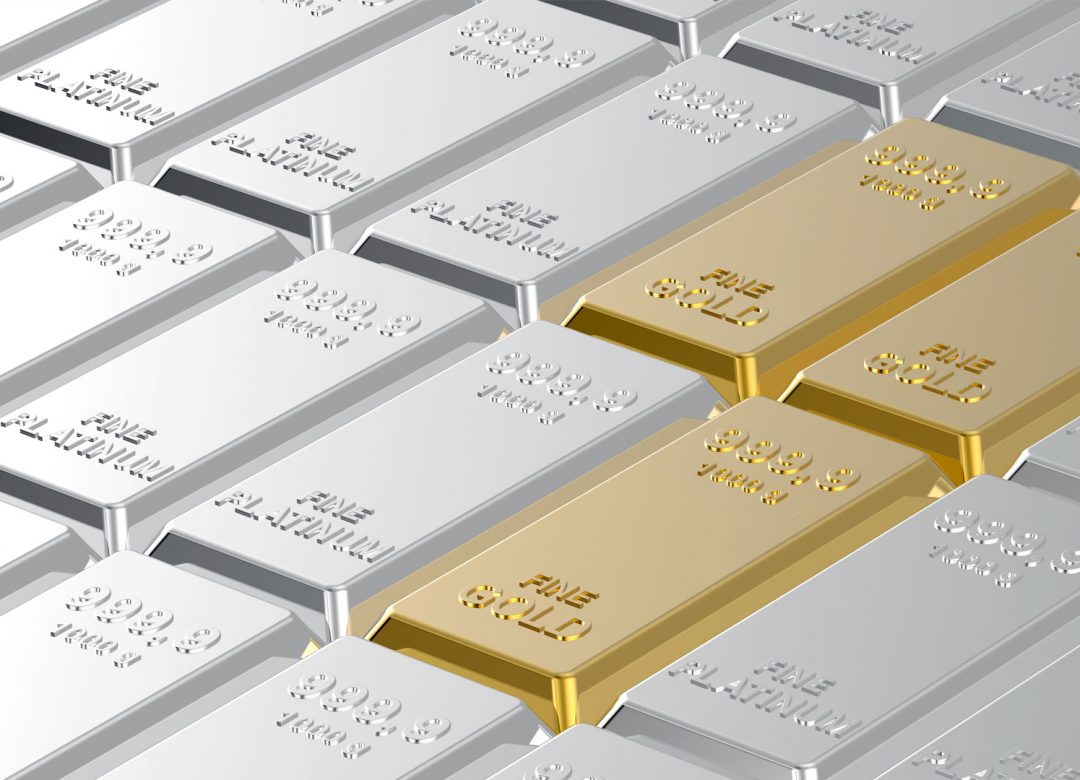
Sibanye-Stillwater achieves level 4 Broad-based bl...
05 Sep, 2024 08:10
S.Africa's ARM pivots to chrome and copper after p...
06 Sep, 2024 12:49
Harmony Gold expects costs to jump after surge in ...
06 Sep, 2024 13:04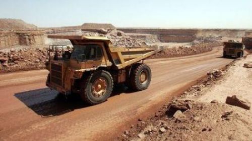
Mali: New Mining Code to Apply to Allied Gold’s Sa...
06 Sep, 2024 13:16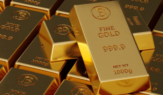
Uganda targets tenfold GDP growth riding on mining...
09 Sep, 2024 07:22
Newcore Gold Announces Upsize of Private Placement...
09 Sep, 2024 08:12
WIA joins West African gold chorus line with new b...
09 Sep, 2024 08:21